Nazka Mapps
Nazka Mapps is a Belgian SME specializing in interactive map applications. Within the SmartConnect consortium, we help bring Earth Observation (EO) data closer to end users in the civil security domain, where clear and timely information is crucial.
Together with Gemsotec, we developed the Intervention Application (INA), a map-based tool that helps fire departments gain a better overview of ongoing incidents. INA is already used by several fire brigades in Belgium, including those in Antwerp and Brussels. Through SmartConnect, we aim to further enhance INA by integrating EO data, improving situational awareness for Belgian fire services, and exploring how the application can support intervention scenarios in other countries and regions.
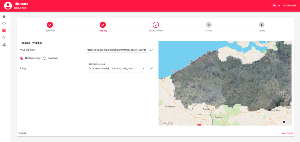
To support this, Nazka Mapps has expanded INA with a geodata interface (GDI) that allows users to easily manage all map information shown during an intervention. The map is prepared to display a wide range of EO data, such as satellite imagery and aerial data, alongside local operational information. This interface will also serves as a single access point to SmartConnect services, making it easy for users to discover and request relevant EO products without technical complexity.
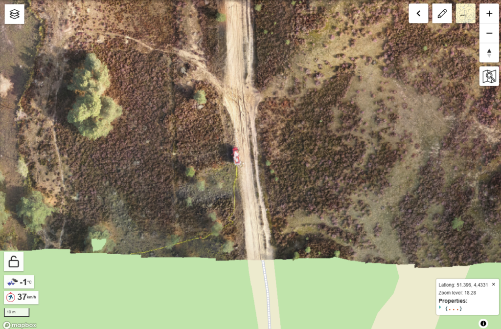
In collaboration with SmartConnect partner VITO, drone footage was successfully transformed into accurate map images and displayed live in INA during a large-scale fire exercise in Belgium. This demonstration clearly showed how combining SmartConnect expertise with EO and drone data can significantly improve situational awareness for first responders.
Our contributions
Making EO data truly usable for first responders
Through the Geodata Interface (GDI), Nazka Mapps makes it easy for INA users to discover, manage, and visualise EO-based information directly within their operational map environment. The GDI supports key geospatial formats such as WM(T)S and GeoTIFF, ensuring that satellite imagery and other spatial data can be seamlessly integrated into daily workflows.
Beyond data management, the GDI is being further developed as a gateway to SmartConnect services. This will allow users to access relevant EO products with just a few clicks—removing technical barriers and turning advanced data into practical, actionable insight during interventions
Bringing EO and drone data into real-life operations
Nazka Mapps actively tested the added value of EO and drone imagery in the field during a large-scale exercise organised by a Belgian fire department in the Kalmthoutse Heide. By integrating live drone footage into INA, the exercise demonstrated how aerial perspectives can significantly enhance situational awareness for incident commanders.
This hands-on collaboration showed how SmartConnect technologies move beyond theory—supporting real operational needs and helping first responders make faster, better-informed decisions in complex emergency situations.